The natural cause is the soils of the dry part of the globe, called the soil, under the influence of conditions, and also the value generated by human activity and forming the product of the plant. The only attribute inherent to the soil is fertility. So soil and fertility are twins. The general characteristic of the soil is the loose layer of the earth's surface, changed by the climate conditions of humans, animals and microorganisms, and by humans.Important factors affecting the soil formation process are plant and animal life, climate, soilforming rocks, terrain, geological age, and human production.On the section of the Kent mountain range, on the slope of the southern exposition and on the terrace above the floodplain, four sections were laid. Before describing the soils and sections taken to participate in the mountain range, it is necessary to explain what the mountain mass itself is, and what is the climate on the terrain, and our other aspects influence and are the factors of soil formation. The Kent mountains are a syntrusive granite mountain massif with heights reaching 1500 m, differing in the variety of landscapes and a more humid climate than in the Karkaralinsk mountain massive. The mountain range Kent itself is represented as large, and by small ridges forming a network of rocky ridges separated by gorges, mountain and river valleys.
Introduction
The genesis of the Kent in 2017 mountains is exactly the same as that of the Karkaralinsk mountain massive, which leaves in the Late — Upper Paleozoic complex. The intrusions formed in the Kent region have a rather diverse form, which gives development to the existence of different soils [1-5].
Arrays of the massive are mainly acidic, which is also one of the factors of soil formation in the given territory. A1 also due to the various forms of relief in the compartment with the climate, lead to the development of accumulation processes, deluvial, eopic, propovial processes. Intrusions and rocks of granites, senites, diorites, as well as effusive and metaporides are overlain by quaternary sediments: eluvial, alluvial deposits of different mechanical composition. As a result, the main types of soils in this metchnost are: chestnut and their zonal pigments (meadow-chestnut, meadow) soils. Soils in the Kent mountain range are formed mainly under the influence of three factors: zoning vertical, the geological structure of the terrain and its features, as well as the sod factor [3, 4].
On 2017 June 22, up to 4 cuts were laid along the route: before the hollow and above it (1-14 and 1-15 respectively), on the slope (1-16), and on a shallow surface (points with a cut 1-17).
Section 1-14 was laid on the gentle part of the southern slope with a steepness of up to 100, length up to 50 m. The peculiarity of the location of the cut: the incision is laid near a hollow filled with water in a sucker. A small incision is 14 cm. The reason for this power is the presence of water, which is opened at a depth of 14 cm, due to accumulation [1, 5, 6].
The section is characterized by the presence of two horizons: A0 (horizon of litterfall) and Am (peat horizon). A0 is an adipose litter with salt and litter from other different plants. The color is 2.59. AT peat horizon, it has a dark gray color (2 5/1) because of the humidity, it is close to black, rather wet and for this reason is unstructured, as well as due to the presence of roots and bark of the lute, with the inclusion of targets up to 0.5 cm, the layer is rather loose, tattered [2, 3].
The next cut 1-15 is located higher on the slope than the cut 1-14, in a less humid place. Its thickness is 33 cm, in view of the distance from the swarming of the trough waters. There are also two horizons, the upper one is replaced by peat A"r1, has a dark gray black color (2.5 U, 2.5/1) wet; because of this, it is unstructured, light loam in texture, roots up to 40 %, coarse clastic material up to j-7 cm, the period is clear by decreasing the number of roots, the border is slightly arched. In the underlying horizon, A12, almost everything is analogous, except perhaps in the increase of coarse-clastic material to 60-70 % [5-7].
Further down the slope follows a cut 1-16-17 with four soil horizons: Hell (sod), B (Ca) (carbonate), BCa. The thickness reaches 40 cm, and is limited by the presence of a large amount of coarse detrital material represented by basalts, aniuronite, granite in the form of large blocks, which is further complicated by thedark gray black (7.5 YR) 2.5/1 in the slope of the ad of this soil), because of the abundance of roots, 70 % is weakly structured, with inclusions of rubble, it does not boil. Transition is clear by increasing the roots, slightly wavy border. The underlying A1 (7.5/2) — 11/12) is dark gray (7.5 YR 2.5/2), homogeneous, fresh, wetter than the previous one, fine-grained, light loam, inclusions of crushed stone to lumps 22 cm to 40 %, does not boil. The transition is analogous, horrible in color with a wavy boundary. The next two horizons are practically the same B (Ca) (11-30.5) and BCa (30.3-40), the color is reddish-brown with whitish spots in B (Ca) (7.5 YR 3/3) in B(Ca) — 5 YR 4/6, both fresh, BCa fresh in color with inclusions of crushed stone and blocks up to 22 cm with carbonate film, so BCa boils more than B (Ca) due to the greater availability of different types of carbonates in the soil horizon [8-10].
The presence of carbonates in the soil is explained by the different inclusions of the states, carbonates to other varieties of inclusions in the granitic soils. And one of the factors is the presence of a contact zone. Just saturated with the same intrusion of water with CaCO3, flows down the slope, then saturates the soil with carbonates, creating an eluvial type of distribution of carbonates in the soil. With the presence of CaCO3 values and pH from sections 2-14-1-17 increased, from acid medium 4.7-5.2 pH in 1-14, 4.4-4.7 pH in 1-15 to 6.4-8,2 pH in 1-16-17, acquiring neutralization of the acidic medium with the transition to neutral, alkaline, all due to the presence of carbonates in the horizons [10-12].
The next incision 1-17-17 was laid on the flat surface of the terrace above the floodplain at 70 cm to the leg from 1-16-17. There are four horizons in it: Hell, A1, AG, BG (gley). Its thickness is 65 cm. The first is Hell, dark gray (10 YR ¾), homogeneous, the transition is gradual. The next A1 3 (4) — 25 dark gray (GA, 12,5/N) with a bluish shade, dry, close to fresh, the main feature of the soil of this section in the granular structure, which is traced in the horizon A1 and underlying horizons, according tothe mechanical composition of light loam, compacted, boils, a clear transition to a reduction in the number of roots, the border is slightlywave. Effervescence is due to the presence of carbonates in various forms. The remaining two horizons are gleyed, and this is determined by the presence of bluish shades of AG (2.5 V 2.6/1), BG (10 YR 2/7). AG has a grayish-brown color (2.3 V 2.6/1), fresh, granular, light loam loamy, denser than A1, roots 7 % c j to 0.5 mm. The transition is clear in color, the plate is slightly wavy.BG 55 — 656 light brown graygray (70 YR 2/1), fresh AG, with the same granular structure, SS, denser than yours, the roots are single with j to 0.5 mm, when the pH turns gray in this soilIncreased from 7.9 to 8.6 down the profile of the cut. He also conducted a gauntlet analysis of water in the stream near the incision, the pH in which was found to be 7.6. From this there is an explicable alkaline medium in the soil of the cut point 1-17-17. Under the assumptions, the soil in this section is black earth, since it corresponds to it in all parameters [12-14].
On the four slopes of the southern exposure slope to the adjacent flat surface, it is possible to clearly distinguish the differentiation of soils down the slope, from forest, sod to black earth soils on the surface of the terrace above the floodplain near the stream. This is the variety influenced by determined factors, which have already been distinguished by the BG text. In the case of cuts 1-14 and 1-15, the brightest factors are the trough with water and the soil-forming rocks. In the sections 1-16 and 1-17, there were complexes of factors responsible for soil formation.
Soil differentiation along the slope and below in the sections was very patriotically traced and characterized in themselves: 5 factors: soil-forming rocks, living organisms, which was very clearly observed in sections 1-14, 1-15, as well as a factor of time [2, 3, 14].
One of the key areas of educational practice on soil science was located within the small-sap soils foothill massive of Karamyrza.7 sections were laid on this site. The array is composed of tuffolavas, andesites and other effusive rocks [3, 4, 15].
In this section, an analysis of the morphological and chemical properties of the upper (1-8-17) and middle (1-10-17) parts of the convex slope of the southwestern exposition shows the trans-eluvial and eluvial landscapes of the gentle slope. In the section 1-8-17 (p No. 8), dark chestnut carbonate low-power loamy soils on eluvial deposits (KK13 NC/еĢ) were described. In the section 1-10-17 (р No. 10), darkchestnut medium-thick carbonate light loamy soils on deluvial-eluvial deposits (KK23 ls/d-e Q) were described [7, 9, 16].
Р No. 8 was laid on the upper part of the slope of the southwestern exposure of the slope of the summit surface of the foothill massive of Karamyrza with a mark of 850 m. The steepness of the upper part of the slope is -120, and the distance from the top to the cut is 25-30 m. Soil-forming rocks here are eluvial deposits. The vegetation cover is underdeveloped (PPP = 30-40 %), it is represented by a hawthorn and wormwood with the participation of spiraea citadel, spiraea sparrows and bedrocks hereby. The surface of the soil is weakly retained. Throughout the depth of the cut, the soil is poorly structured due to abundant inclusions of crushed stone and gruss; causes the amount of rubble and its size increases with depth. The effervescence of the soil from HCl (10 %) differs from a depth of 31 cm (in the Bca horizon, in which clayey inclusions with a carbonate film-beards and single carbonate neoplasms) occur. The genetic profile of soils consists of 5 horizons: Aд-Aı-Bсa-C-D [3, 10, 16].
The horizon of Hell according to the Munsell table has a color of 7.5 YR 4/4 (grayish-brown), poorly structured due to abundant inclusions of roots and rubble (10 %). There are lumps on the roots [9, 11, 15].
Horizon A1 in color is brown (10 YR 3/3), also weakly structured due to the abundance of roots and rubble (20 %), but it is denser than the horizon of Hell. The mechanical composition is a light loam, passing to the middle one [1, 8, 11].
Horizon Bсa brownish — light gray (2.5 YR 5/6), the structure is also weakly expressed, but has prismoid elements denser than the overlying one. Here, carbonate neoplasms already occur. With increasing depth, the percentage of inclusions of crushed stone (40–50 %) also increases (Table 1).
Table 1
Comparative characteristics of morphological and chemical properties of soils p No. 8 and р No. 10
|
Vegetative association (PPP, %) |
Kovylno-wormwood (PPP = 30–40 %) |
Grain-feather grass with participation of herbs (PPP = 60–65 %) |
|
Power of soil profile |
44 sm |
64 sm |
|
Carbonate neoplasms |
+ 30(31)sm(B) |
+37sm (Bcafe1)) |
|
Gypsum neoplasms |
+44sm (Д) on the rubble |
+37(38)sm Bca(cs) (5 — 10 %) |
|
Effervescence from HCl, depth |
30(31)sm (B) |
37sm(Bca(cs)) |
Horizon C differs from the overlying only in that the detritus inclusions sharply increased (80 %). Horizon D — substructure, here we met gypsum neoplasms (smudges on the surface of rubble).
Р No. 10 was laid down the slope from р No. 8 in 120 m to the south-west, it is in the middle part of the southwestern slope of the hill of the foothill massive of Karamyrza (Table 1). The steepness of the middle part of the slope is less than the steepness of the upper part (does not exceed 10–110). Soil-forming rocks are deluvial-eluvial deposits. Here the vegetation is more developed than on the upper part of the slope (PPP = 60–65 %). The vegetation cover is represented by feather grass and individual representatives of the grass stand, such as timothy, plantain and wormwood. Surface in most of the dazed. The soil effervesces from HCl (10 %) with 37 cm (Bca (cs)). The genetic profile consists of 4 horizons: Aд-Aı-B-Bсa(cs) [3, 4, 12].
Horizon Ад dark brown — gray (7.5 YR 2.5/2). The moisture content of the soil in this horizon is greater than in horizon A1 of section No. 8. The structure is small and medium cloddy. Inclusions of rubble are less pronounced than in p No. 8 (5 %) [2, 11, 15].
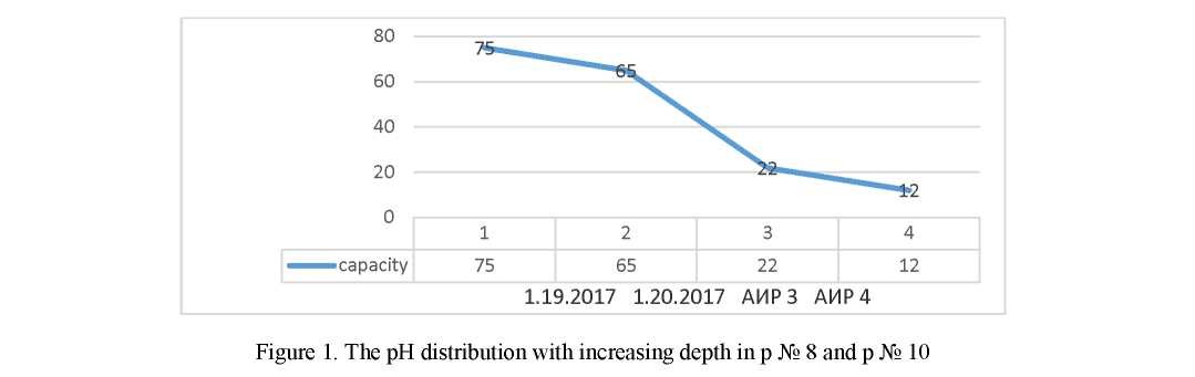
The horizon B is light brown (7.5 YR 3/4), it is heterogeneous due to inclusions. The structure is prismatic. The mechanical composition is a light loam, close to the average. The inclusions of detritus are greater than in hor. A1 (10 %) [3, 4, 9] (Figs. 1, 2).
Horizon Bca (cs) light brown (7.5 YR 4/4), heterogeneous, has whitish and rusty spots, which is due to the content of carbonates and iron (III). The structure is expressed, has a prismatic structure, which goes over to the plate-like structure. Mechanical composition — light loam. Sharp increase in gravel material (35 %). In this horizon there are single gypsum neoplasms [4, 7].
Analysis of chemical-analytical research has shown, that:
- In the course of cutting, there is no refinement;
- Amount has an eluate type of pH in the cuttings. Total Range. The pH ranges from 0.8 to 8.2. The maximal pronounced carbonate horizon. At the bottom profile, the upper part of the slope differs from the residual differentiation of the pH by increasing the pH of the glue. Minimum defenseless to coarse to the humus, humus horizon [1, 2, 5].
Outputs: In the section of cuts are made of gypsum and carbonate novelty in the bottom part of the profile (rags on the thistle), which is one of the main characteristics of chestnut pole. There are grayblubbing materials (plum and dresva) with the top of the upper horizon and to the zabei. In sections 1–8–17 and 1–10–17, it is necessary to exclude the color and scattering of carbonate horizons [5, 8, 14].
On the Kara-Myrza mountains section, 3 sections were laid on the slopes from the northern and southern exposures. Two of them are laid in the wolfed part of the slope [1, 3, 15].
Section No. 1–7–17, which characterizes meadow chestnut soils, is located in the valley of the slope with a northern exposure [4, 7, 16].
The area of the projective cover (PPP) reaches 50–60 %. Vegetable association — yarrow — feather grass. The features of the soil surface are represented by drought and last year's herding of herbaceous vegetation. The morphological profile consists of the following genetic horizons: A^Ai^i'-AB-BC-C [5, 6].
The sod horizon of Hell has a power of 3 (4) cm. It is dominated by dark gray colors (according to the Munsell table — 10 YR 2/2). The transition to the underlying horizon is gradual.
Three organic-mineral horizons were installed for this section: A1, A11, AB. The total power is 44 cm [6, 9, 10].
Horizon A1 has a brownish gray color (5 YR 2.5/2) and a uniform coloration. Inclusions of crushed stone, the dimensions of which do not exceed 2 cm, are equal to 5 %. In this horizon there is a soil fauna represented by ants. The difference between the horizon A1 and A11 is that in the horizon A11 the percentage of crushed stone (60 %) increases, the structure is medium-lumpy and brownish shades predominate in this horizon [11–13].
In the soil profile, two transition horizons are distinguished: AB and BC.
The horizon AB is morphologically similar to the horizon А11. The difference in horizons is a prismatic structure, a decrease in the number of roots to 2 %, and the size of rubble is increased to 3.5 cm in the horizon AB [1, 2, 15].
The horizon of the Sun lies at a depth of 48(49)–67(68) cm. It has a rusty — light brown color, according to the Munsell table — 10 YR 4/6. The coloration is heterogeneous due to inclusions of gravely, crushed stone, the amount of which reaches 80–85 %. The transition to the underlying horizon is clear from a change in the size of the inclusions [3, 5, 15].
The soil-forming horizon — C1, whose thickness is equal to 9 cm, has a greenish color, close to olive, with a brownish hue. The greenish shade of the horizon is attached to weathered rubble. According to the Munsell table, 10 YR 4/4. Because of the inclusions, the coloration pattern is not uniform. The number of inclusions of sand and grime is 75–80 % [3, 15].
Not one of the horizons of section No. 1–7–17 boils from HCl (10 %), becausedo not have carbonate neoplasms. Profile is leached [3–5].

Soil profile No. 1–9–17 is located in the valley of the southern exposure slope. The features of the soil surface are traces of livelihoods of livestock and the presence of last year's litter of herbaceous vegetation with a thickness of 0.5 cm. The area of the cover coating is 65 %. The vegetative association is grassy- shrubby-herbaceous. The morphological profile is represented by 4 genetic horizons: A^A1-A1 B-СД [1, 5, 15].
The capacity of the horizon A, as in the first section, is 4(5) cm. The horizon is densely permeated with roots (70 %). The profile clearly shows the humus horizon A1, whose thickness is 10(12) cm. It has a brownish-gray color (10 YR 2/2) with a homogeneous coloration. The structure is cloddy, caused by the presence of roots (40 %) [3, 7].
Morphological description of horizon A1B is similar to horizons A1. The difference lies in the fact that coarse clastic material reaches a diameter of 3 cm (60 %), the number of roots decreases to 30 %. The horizon AB in comparison with the overlying one is not clearly structurally structured with lumpy elements [1, 3]. There is another transition horizon — СД with a thickness of 10 cm. It is more dominated by shades of brown than in the horizon A1B. Because of its large size, it is unstructured from 7 to 8 cm [3, 7].
In this section, as in the previous one, the horizons do not effervesce from HCl. Both sections were laid in the undulating part of the slope. In addition, we will describe the cut No. 1–10–17, which was laid in the convex part of the slope with a southern exposure. Vegetative association of cereals — feather grass. Projective coverage is 65 %. The cut has four genetic horizons: A'l-A∣-A-Bca (cs) [7, 16].
The dernian horizon of this section is more powerful than in the previous two and reaches 6 cm.
The thickness of the humic horizon A1 is 20(21) cm. The horizon has a dark brownish-gray color (7.5 YR 2.5/2), a homogeneous coloration. The transition to the underlying horizon is clear in color, decreasing the number of roots and increasing the detritus material [5, 11].
The illuvial horizon B, whose power range is 26(27)–37(38) cm. The horizon has a prismatic structure, light brown color (7.5 YR 3/4) and a heterogeneous coloration due to inclusions. Inclusions of detrital material with a size of 1.5×1 cm (10 %). More dense than overlying [8, 9].
The horizon Bca (cs) is expressed, which effervesces compared to other horizons, which is explained by the presence of carbonates and gypsum. The horizon has a light brown color (7.5 YR 4/4) with whitish and rusty spots, so the coloration pattern is inhomogeneous. Whitish spots are caused by the presence of whitish- gravelly material (70 %). Gypsum neoplasms make up 5–10 %.
In the laboratory conditions, the chemical parameters (pH and TDS) were determined. From these data, it is also possible to identify the differences and similarities of the three sections.
In section (Table 2) No. 1–7–17, the soil horizons have a neutral reaction of the medium, sincethe pH values of the meter range from 6.8 to 7.5, the difference being 0.7. With depth, the indices decrease, but in the horizon A11 sharply increases (pH = 7.5). This may be due to the strong development of organic processes in this horizon [8, 9].
In the section (Table 2) No. 1-9-17 samples of the two upper horizons were selected. In the horizon Äд, pH = 6.5, and in the horizon A1 = 6.0. Presumably in this profile the reaction of the soil solution is weakly acidic.
Table 2
Comparative characteristics of the morphological and chemical properties of the sections No. 1–7–17, 1–9–17 and 1–10–17
|
Properties |
1-7-17 |
1-9-17 |
1-10-17 |
|
Exposition |
Northern |
Southern |
Southern |
|
Humus horizon thickness |
18 сш |
10 сш |
20 сш |
|
Reaction from HCl (10 %) |
- |
- |
Effervesces from 37 cm |
|
The presence of CaCO3 and CaSO4∙H2O |
- |
- |
+ |
|
Power Ад |
4(5) сш |
4(5) сш |
6 сш |
|
РРР |
50-60 % |
65 % |
65 % |
In the section (Table 2) No. 1-10-17, pH ranges from 7.0 to 8.2. With depth, the values increase. This increase can be explained by carbonate and gypsum neoplasms in the illuvial-carbonate horizon. In this profile, the eluvial type of distribution, in which there is a consistent increase in the content of matter from the upper horizons to the lower horizons.
Meadow — chestnut soils of the slopes of the northern and southern exposures are characterized by leaching from СО3. The effect of exposure is manifested in the presence on the slope of the northern exposure of the more powerful horizons A1.
The soils of the middle part of the slope of the southern exposure are distinguished by the presence of carbonate neoplasms and effervescence in the middle part of the profile, which allows them to be diagnosed as dark chestnut medium — thick carbonate light loam on deluvial — eluvial deposits [11, 12, 14].
References
- Zhamalbekov, E.U., Bildebaeva, R.M., & Bigaliev, А.В. (2001). Zhalpy topyraktanu [General Soil Science]. Almaty [in Kazakh].
- Tazabekov, T.T. (1999). Topyraqtyn qunarlylygy. [Soil fertility]. Almaty [in Kazakh].
- Dobrovolskii, V.V. (1999). Heohrafiia pochv s osnovami pochvovedeniia [Geography of soils with the fundamentals of soil science]. Moscow: Vlados [in Russian].
- Asanbaev, I.K., & Faizov, K.Sh. (2007). Pochvovedenie s osnovami ekolohii i heohrafii pochv [Soil science with the basics of ecology and geography of soils]. Almaty: Qazaq universiteti baspasy [in Russian].
- Kovrigo, V.P. (Eds.). (2000). Pochvovedenie s osnovami heolohii [Soil science with the basics of geology]. Moscow: KolosS [in Russian].
- Dobrovolsky, G.V., & Urusevskaia I.S. (2004). Heohrafiia pochv [Geography of soils]. Moscow: MGU Publ., KolosS [in Russian].
- Dobrovolskii, V.V. (2004). Zadachi pochvovedeniia v reshenii sovremennykh ekolohicheskikh problem [Soil science problems in solving modern environmental problems]. Saint-Petersburg: TsMP [in Russian].
- Mukha, V.D., et.al. (2003). Ahropochvovedenie [Agrarian science]. Moscow: KolosS [in Russian].
- Kovda, V.A., & Rozanov, B.G. (Eds.). (1988). Pochvovedenie [Soil Science]. (In 2 parts. Pt. 2). Moscow: Vysshaia shkola [in Russian].
- Toleubaev, Zh.S., & Orazbaev, Q.I. (2015). Qoldanbaly biolohiia zhane topyraqtanu nehizderi [Applied biology and basis of soil science]. Almaty: Evero [in Kazakh].
- Zhamalbekov, E., & Bіldebaeva, R. (2006). Topyraqtanu zhəne topyraq heohrafiiasy men ekolohiiasy [Soil science and soil geography and ecology. Almaty: Qazaq universiteti baspasy [in Kazakh].
- Denisova, S.I. (1999). Polevaia praktika po ekolohii [Field practice in ecology]. Minsk: Universitetsae [in Russian].
- Diuisenbekov, Z.D., Taizhanov, Sh.T., & Shaushekov, T.Q. (2012). Topyraqtanu zhane heobotanika nehizderi. [Soil science and geobotanics basics]. Astana: Arman-PV [in Kazakh].
- Kovda, V.A., & Rozanov, B.G. (Eds.). (1988). Pochvovedenie [Soil Science]. (In 2 parts. Pt. 1). Moscow: Vysshaia shkola [in Russian].
- Kovda, V.A., & Rozanov B.G. (Eds.). (1988). Pochvovedenie. [Soil Science]. Moscow: Vysshaia shkola [in Russian].
- Taizhanov, Sh.T., Amralin, A.O., & Koshkarov, N.B. (2008). Topyraqtanu zhane heolohiia nehizderi [Soil science and basics of geology]. Astana: Oqulyq [in Kazakh].